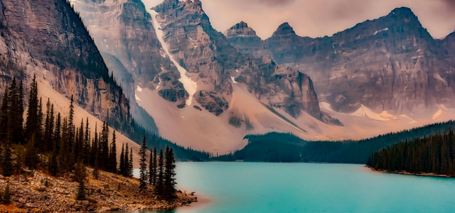
The Canadian state is an embodiment of
beauty. A naturally gifted place of gorgeous landscapes and sceneries. Being
the second largest country in the world, Canada is naturally blessed with
diverse geography. This concise article is aimed to serve as a guide to better
understand the state’s geography. You should be able to understand its land
markings plus other exciting facts about Canadaafter reading it.
About
Canada:
Canada was coined from the word ‘Kanata’
which translates to ‘village settlement’. Although, it is scarcely populated,
Canada is however the second of the largest countries in the world occupying
nearly two-fifth of the entire North America. The country is positioned within
the North Atlantic and the North Pacific Oceans occupying the landed area
in-between. To the South, it shares boundaries with the United States and also
to the Northwest.
Brief
History:
About Two Thousand Indians were the
foremost settlers of the present-day Canada. However, the Europeans started
moving in around the 16th Century and this resulted to mixed
population up until 1950. Today, the status and non-status Indians can be found
living in the country alongside the Inuit, within their respective formed
territories.
Main
Cities:
Ottawa is the capital of Canada. Though,
Toronto is the largest city followed by Montreal while Vancouver is the third
largest city in Canada. This means that Ottawa is the fourth largest city in
relation to population, culture, economy and resources, compared to the
aforementioned. To the Northwest of Toronto lies Ottawa at a distance of
approximately 250 miles, and 125 miles to West of Montreal. Winnipeg, Alberta,
Quebec City, Calgary, Manitoba and Edmonton are also major cities and areas in
Canada.
Toronto, the main city of Canada, covers
approx. 630 sq.km and has a 46-km long waterfront shoreline. Toronto Harbor is
formed by the Toronto islands and Port lands. Lake Ontario & Etobicoke
Creek form the borders of the city along with Rouge River & Steele’s
Avenue.
Climate:
The climate of the Canadian state is
diverse and temperatures varies depending on the region. Snows can be found
towards the far North while warm summer exists in the summer continental climatic
zones. In a 1937-1947 estimation recorded, the temperature varies from 45◦C
in Midale to -63◦C in Snag, Yukon.
Main
Languages and Population:
Canada is a bilingual country. It uses
English and French, both as the country’s official languages. This indicates
its history with the two greats of Europe.
In the April of 2015, Canada’s
populationwas estimated to be around 35,794,600. It has a population density of
about 3.5 people per square kilometer, majorly concentrated towards its
Southern border.
Natural Resources and Hazards:
Canada holds some of the biggest industries
in fishing, agricultural products, mining, petroleum products and forestry.
Fishery can be historically referred to as the its strongest resources. Forestry
has equally been itsmajor resources over the years and lately, the discovery of
fossil fuels, oil and coal deposits has greatly added to its natural resources
explorations.
There is also large deposition of mineral
resources in the country and its large concentration of precious metals and
stones like diamonds is noteworthy.
The continuous permafrost is a natural hazard
Understanding Canadian Geography
 Reviewed by Ravi
on
March 10, 2018
Rating:
 Reviewed by Ravi
on
March 10, 2018
Rating:


No comments: